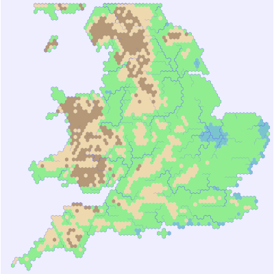
A hex map of England!
I've been using (and testing) my new hex-map library. Here's a map of England.

It was generated by a little program that uses NASA's SRTM data as input. The light brown hills are just high ground, but the dark brown hexes are both high and hilly - my program samples the …
View comments more ... firetree.net